2013-11-30

The John M. Kohn family photos

Yesterday, I received two family photos from my 3rd cousin-once-removed Barbara Schuh. Her father Robert Schuh received them from his godmother Marie Irsch.

The family is the John M. Kohn family, my great grandfather. He was born 1839 in Wasserliesch, Germany; his wife is Susanna Reinert, who was born 1848 in Igel, Germany. These two towns are across from each other on the Mosel River, a few miles upstream from Trier. The couple likely knew each other in Germany before they emigrated—he in 1865 and she in 1867, and they lived 30 miles from each other in Minnesota and Wisconsin from 1867-1872. John M. followed Susanna when she moved with her mother and siblings to Kansas. They married at Waconda, Kansas in 1874.


This photo was taken about September 1881 to June 1882. Susanna likely was pregnant with her 5th child (the 4th child to live through infancy). The children in the front row are Mike J. (born 1879), Peter (born 1877), and Katie (born 1881) . The family had moved to La Crosse, Wisconsin in late 1880--the couple and two sons were in the June 1880 census of Kansas, their daughter Katie was born January 1881 in La Crosse.


This photo was taken about 1887-1889. The children (left to right: Katie (born 1881), Mike J. (born 1879). Ben (seated, born 1884), Peter (born 1877), and Annie (born 1882)) have recently experienced the death of their youngest brother Joseph (born March 1886, died November 1886) and mother (died August 1887). John M. and family moved to a farm near Cawker City, Kansas in 1887 or 1888.


Only a guess, but this photo comes from about 1890, when Katie was about nine years old. Annie was eight in that year, so the other girl seems a bit small to be Annie.


This photo must come from about 1904. The family moved to a livestock farm in Bloom township, Osborne county, Kansas after they resettled from La Crosse. The youngest boy, Ben (left) was born 1884 and appears to be ten to twelve years old here. The two sisters Katie and Annie would be about twelve to sixteen. The older boy, either Peter or Mike J., would be in his late teens. The photographer is likely the other older boy. The father John M. (1839-1919) lived on the farm until his death at age 80.


Other researchers also document some of the family.
  • Peter Kohn (1875-1941) married Elizabeth Ottley (1880-1947) and had a family of 7 children (a sixth child did not survive infancy).
  • Mike J. Kohn (1879-1965) married Louise Ohnsat (1875-1959) and had a family of 8 children (two others did not survive infancy).
  • Katie Kohn (1881-1955) married Phillip Gasper (1877-1964) and had a family of 8 children (a 9th child did not survive infancy).
  • Annie Kohn (1882-1956) married Frank Streit (1881-1951) and had a family of 10 (an 11th did not survive to childhood).
  • Ben Kohn (1884-1955) married Barbara Streit (1887-1974) and had a family of 9.
  • The two deceased infants were John Nicholas (1875-1875) and Joseph (1886-1886).

2013-11-26

Finding the correct town and parish for your German ancestors

For the genealogist, it's easy to get bogged down in adding information from family births, marriages, and deaths among the many cousins, aunts, uncles, grandparents. Usually a family member who knows of your interest sends a note that Uncle Junior has died. It's up to you to find the obituary and document the date and location for the death and burial, corroborate what you already know with the list of survivors and the biographic details.

But keeping track of your contemporaries isn't really enough. You know that a dedicated family researcher goes back toward the beginnings of the family. And often seeks information about parents and siblings of those who have married into the family.

At some point, the family researcher comes to the first immigrant from another country. The research becomes multi-national and usually multi-lingual. That jump across the ocean gets harder and harder for each generation removed from the immigrant. More to the point, it's more difficult to find the town that a family member emigrated from.

Accumulated research can turn up information about the other country in several locations.
  • Civil records (birth, marriage, divorce, or death) that name the parents or spouse and identify the person's home
  • Civil records for an immigrant that identify the country of birth or former citizenship
  • United States federal census enumerations, which ask the place of birth, year of birth or age, and place of birth for each parent
  • Church records (baptism, confirmation, wedding, or funeral) that may name the parents, spouse, or previous church that documents the person's baptism or marriage
  • Anecdotes from contemporaries or children of the immigrant
  • Biographical sketches from contemporary newspapers
  • Tombstone entries
  • Memorial cards from funeral services
  • Obituary notices and biographical sketches

Only on occasion do these sources certainly identify the town of emigration. And even if they do, the information must be met with some suspicion. After all, most of the sources contain information provided second-hand, from relatives of the immigrant. And memory fades, even for the immigrant, who may have left at an early age.

My experience in finding the town of emigration includes great ease and great difficulty.
  • My great grandparents John M. Kohn and Susanna Reinert were part of a family that already has many family researchers. Even before I began to research, their towns of origin in western Germany, close to the Luxembourg border, were known to be Wasserliesch and Igel.
  • My great grandparents Robert Ohnsat and Leopoldina Salinger were ciphers. An elderly cousin had some anecdotes that placed his home at Nysa or on the Nysa River in Silesia and her home at Frankfurt. This was partially true for my great grandfather, but not even close for my great grandmother.
  • My great grandparents Anton Deneke and Maria Anna Stephan had passed on information about their homes of birth, but not much more. His birthplace was known as Hannover, and hers as Königheim in Baden. Both turned out to be correct, though Hannover was the seat of the district government, and his actual birthplace was Brakel in Kreis Höxter.
  • My great grandparents Richard Butler and Mary Ellen Cummings were part of a family that includes several family researchers. As I began my work, I soon found the researchers who had information back to the generation that lived in Thomastown, County Kilkenny, Ireland.
Especially for the Ohnsat, Salinger, Deneke, and Stephan families, I found the International Genealogical Index (IGI) to be of some help. This aid allows you to enter a person's name and other data, which can search information for matches. You can then look through the matches for a likely location to research. I have provided more information in another post, the International Genealogical Index (IGI).

If you have a reliable town name, you can use the FamilySearch Catalog to enter the country name and town name. The catalog will list the corrected country, district, and county in addition to the town. If the town had a church that allowed its parish registers to be microfilmed, the catalog connects to a record that identifies the microfilms. With the microfilm numbers, you can order the microfilm at your local LDS genealogy library.

If you have a town name that is less reliable, you should use a couple of these online sources to find a corrected spelling or a correct district for the town.
  • Contemporary online mapping, such as Google Earth. This can provide a search for the town name, though it does not typically offer alternatives to misspelled names.
  • A listing of town names by country and area, such as the Global Gazetteer. Select a country, and then select a region or begin searching right away for the town name.
  • Go to a version of Wikipedia for a specific language (for example, French, German, Irish, Italian, or one of nearly 50 others) and enter the town name. Wikipedia provides a large number of alternatives if the spelling is not exact.
  • Try to find a web page for the town by using the format www.TOWN.COUNTRYCODE (for example, www.Wasserliesch.de).
  • Try to find the town name from a web page for the region or state by using the format www.REGION.COUNTRYCODE (for example, www.trier-land.de, www.hessen.de, or www.deutschland.de).
Happy hunting!
Tom
© Thomas G. Kohn, 2013.

Notes for further additions to this post

The records that cite Mesenich, Igel and Igel, Trier are listing the community (or parish), followed by the next higher level of church or civil government. In the opening pages of a microfilm of parish records, you would see listings of towns for Parish, Deaconate, Community, Civil Region (Pfarrei, Dekonat, Gemeinde, Regierungsbezirk). Also the microfilm's first pages would identify the archive (for example, the Trier Bistumsarchiv).

Mesenich and Metzdorf, being smaller towns that didn't (ever? occasionally?) have a parish church of their own, would be documented in the parish records of the next larger, nearer community where the family went for church services. This could be Langsur, Griwenich, Wasserbillig, or even Igel. If you go to Google Earth, you can see that all of these towns are within easy walking distance; none more than perhaps 5 miles distant, even by a winding road along the river.

So if you start searching microfilms of parish registers, you have a bit of duplicated effort, until you find the first entry of relevance for your Konzemn ancestors. From that point on, you might assume that at least for a couple generations, the family wouldn't change its choice of parish.

I do have a few of the many church records of which parishes were aligned with a deaconry. Their information is pretty well represented by the catalog structure of the LDS microfilm library.

2013-11-13

Houston County, Minnesota—Catholic parishes in Caledonia

First publication 2013.11.14. © Thomas G. Kohn, 2013.

In 1867 to 1871, the Reinert family likely were members of St. John the Baptist church in Caledonia. Other Catholic churches in the county were more distant, in Hokah, Brownsville, and La Crescent. The St. John church was built in 1857 on the site now occupied by Merchant's Bank at Washington and Kingston streets. The church was rebuilt in stone in 1862. The church served the Irish, German, and Luxemburg Catholics who settled in the Caledonia area until 1870 when a second, German-speaking parish formed. Both parishes used the same cemetery, which is named Calvary Cemetery and located on Route 249, about 3/4 mi southeast of the Catholic church.

Figure 5. St. Peter Catholic church,
Caledonia, about 1900.
The German parish constructed St. Peter’s Church from Brownsville limestone, hauled by wagon 14 miles uphill over rough roads. Primary construction was completed in 1872, a bell tower was completed in 1873, and three bells were installed. In 1925, the bell tower was replaced with the current structure. In the early 20th Century, St. Peter’s church was renowned in the region for its large and densely planted gardens.[5]

After a fire destroyed part of the St. John church in the 1950s, the two congregations merged instead of rebuilding the Irish church. The St. Peter’s church was renamed St. Mary’s in 1976. The history of these parishes are documented in the painted glass windows: John the Baptist is on the north side, St. Peter on the south side, and St. Mary is between them in the apse.


Figure 6. St. Mary Catholic church, Caledonia.
In 2002 St. Mary’s received a major refurbishment. Two transepts were added and the altar was moved forward. A foyer was added to the front of the church, as well as a corridor to Holy Family Hall. In 2004 the parish of St. Patrick’s in Brownsville joined St. Mary’s in a diocesan clustering plan. The churches have separate pastoral offices, but they share a pastor, who currently is Matthew Fasnacht.[6] The St. Mary’s Bazaar usually falls on the last Sunday of October.

The parish records from 1866 (marriages), 1868 (baptisms), and 1874 (burials) through the present are handwritten. They are neither microfilmed nor duplicated in the diocesan archives in Winona, Minnesota. I have seen the parish records and photocopied several pages. Two loose, unnumbered sheets are inserted before the bound pages.

Figure 7. First unnumbered page,
St. Mary parish register.
These sheets document baptisms from mid-1868 on one sheet (Figure 7) and from late 1868 through February 1869 on the other. The handwriting differs from handwriting on the numbered, bound pages, and the entries are not signed. I infer that the two loose sheets indicate another parish register existed, perhaps to document the acts performed in St. John parish. More research is needed to find the missing parish register, which might document the burial of John Reinert. Neill’s statement that the sacraments were performed as early as “1855, when itinerant missionaries from Wisconsin, and perhaps Winona, visited the settlement, and held mass at private houses” and identifies the priest Michael Pendergast.[7]


Figure 8. Marriages, pages 2 and 3,
St. Mary parish register.
The bound and numbered pages begin with marriages of 1866, 1867, 1868, and 1869 on pages 2 and 3 (Figure 8).


Figure 9, Baptisms, page 35,
St. Mary parish register.
Page 35 is the next I have photocopied. The handwriting is the same as on pages 2 and 3, and its baptismal entries of 1868 have the pastor’s signature, Mathias Hurenberg. Page 51 is the fourth page I have, and its baptismal entries of 1870 are signed by pastor K. Körbel. The remaining photocopied pages 56-59, 61, 62, 68, 70, 71, 75, 76, 78, and 70 also contain baptisms 1870 to 1873 entered by Körbel.

Previous sections: Background for family history
Next sections: Local Development, History, Reinert History in the Area, Travel to Kansas in 1872, Tipton KS, Seguin KS, La Crosse WI

Notes

5

Neill, Rev. Edward D., History of Houston County including Explorers and Pioneers of Minnesota and Outline History of the State of Minnesota. Minnesota Historical Society, 1882. pp. 360-361: “The present pastor [of St. John the Baptist] is Rev. Father Shanahan, who has a residence near the county buildings on Marshall Street. The building ... was erected during the earlier years of the [Civil War]. the Rev. Charles Koeberl being the resident priest at the time. The earliest meetings in town must have been held in 1855, when itinerant missionaries from Wisconsin, and perhaps Winona, visited the settlement, and held mass at private houses; the first of these remembered was Michael Pendergast. ... Rev. Father F. Essing was the first regular priest here, and he was followed by Rev. Mathew Sturenberg, who was familiarly called Father Mathew; Rev. Father Muchelberger, and then Rev. Charles Koeberl. The language using in this church, aside from the Latin ritual, is the English, as most of the congregation have this as their mother tongue.
“St. Peter’s Church.—This congregation and church is made up of those Catholics in Caledonia and vicinity, who use and understand the German language. A separation was made in the year 1873, when the present church was completed. ... In connection with the church is a parochial school under the charge of the Sisters of Notre Dame. There are about 100 pupils. The Rev. Charles Koeberl was in charge when the church was built. Rev. John Zuzek has been the pastor since June, 1878, and the congregation now numbers 165 families.”

6

The church is located at 513 S. Pine St. The parish office is immediately north of the church. Enter from the parking lot at the corner of South and Pine Streets. Addresses: P.O. Box 406, 453 S. Pine St., Caledonia MN 55921-0406. Bookkeeper and secretary: stmaryschurch@acegroup.cc. Phone 507-725-3804. Hours: Monday through Thursday: 8:00 a.m. to 4:30 p.m., Friday: 8:00 a.m. to 4:00 p.m Current information at their website.

7

Neill, p. 361.

Houston County, Minnesota—local development


First publication 2013.11.15. © Thomas G. Kohn, 2013.

As part of southeastern Minnesota, the county is in the “Driftless Zone,” which is marked by the absence of glacial drift[8] and presence of bedrock cut by streams into steep hills. The plateau that surrounds Caledonia includes flat, fertile farm land and hilly, verdant pasture land.

Figure 10. Mississippi transportation, undated.
Navigation up and down the Mississippi encouraged growth of the county (Figure 10). Records of river transport document shipping from as early as 1844. The shipping season typically opened in April, after the river is free from ice. In 1855, a ferry from La Crescent to La Crosse was licensed. Named the “Wild Kate,” it operated without a regular timetable from its normal berth at La Crosse (Figure 11). Two horses powered a treadmill for the crossing. An unreliable steam ferry named “Honey Eye” soon replaced Wild Kate. However, its steam engines had little capacity, and often the ferry “had to tie up to an island, let the steam go down, take off the safety valve, and with buckets fill the boiler, then get up steam again and finish the trip.”[9] After two years of such service, the ferry was abandoned and another company provided better service through 1878.

Figure 11. Mississippi ferry at Redwing, about 1900.
Railroad companies were provided bonds for building by the Minnesota Supreme Court in 1857, in the face of popular and legislative opposition. However, referenda and laws were passed that obstructed state bonds for railway development through 1860. Although the battle over state funding of railway building raged until 1881, the private companies began to install their lines. “A part of the great St. Louis and Minneapolis line runs through the county north and south near the Mississippi River. Another road runs in the valley of the Root River east and west, connecting with the Mississippi road at the river. The third railroad in the county is the ‘Caledonia and Mississippi,’ which, from the junction on the river, follows up the Crooked Creek in a northerly direction to Caledonia, the shire town, where it deflects toward the south, and passes through Spring Grove, and thence on to Preston, its present terminus. This line was undertaken by local enterprise and is of the standard narrow gauge.”[10]

Figure 12. Harvesting flax.
It is possible that John Reinert brought tools of his trade with him to pioneer America, where there would be a ready market for both linen thread and cloth. This hypothesis may be hard to prove, since tax records have not been found to date. Writing in 1882, Neill reported that flax cultivation had begun with one acre in 1878, which produced four bushels of seed.[11] Even through the 20th Century, Minnesota was one of several states that devoted many acres to flax.[12] Flax had become competitive in northern states like Minnesota because these states need fast maturing, cool season crops. Flax can be planted in April, as soon as the soils begin to warm, and it can be harvested in August (Figure 12), well before early frosts.[13] However, since about 1970, American flax production has failed to compete with imported textiles, whether as raw materials or as finished goods. The plat maps of 1931[14] report that neighboring farms to the Reinert home had cattle, hogs, chickens, and geese. An average 120 acres of each farm supported the livestock with grain and pasture.

The county population grew quickly in the 1860s, decreased slightly from 1900 to the 1930s, and gradually grew to the 2010 population of 19,000.[15] The town of Caledonia has grown steadily, although slowly. La Crescent growth began only in the middle of the 20th Century, and its growth has been the driver of county growth since then. Of the other villages and townships, only Spring Grove village, Houston village, and La Crescent township have 1000 residents or more. The remaining 19 villages and townships have not grown much beyond populations of 500 each.

Figure 13. Root river in Houston county.
The Root River and its broad floodplain (Figure 13) divide the county into a north third and a south two-thirds. In the north are the villages of Money Creek (unincorporated), Pine Creek (unincorporated), Houston (population 979 in 2010), Hokah (population 580), and the largest town of the county, La Crescent (population 4,830). La Crescent overlooks the Mississippi floodplain and slow-moving river, almost directly west from La Crosse, Wisconsin. South along the Mississippi are the towns of Brownsville (population 466) and Reno (unincorporated).

The southwestern two-thirds of the county populate the rolling plateau above the Mississippi. Caledonia (population 2,868) sits in the center. The other towns on the plateau are Yucatan (unincorporated, township population 351), Sheldon (unincorporated, township population 289), Black Hammer (unincorporated, township population 326), Riceford (unincorporated), Newhouse (unincorporated), Spring Grove (population 1,330 and Spring Grove township population 422), Wilmington (unincorporated, township population 472), Eitzen (population 243 and Winnebago township population 257), and Freeburg (unincorporated, Crooked Creek township population 323).

Figure 14. Map of Caledonia, 2001.
The town of Caledonia is a typical American small town (Figure 14). The streets are broad and mostly planned in a matrix of parallels and right angles. The businesses form a tightly-knit downtown that has stood for one hundred years or more (Figure 15). The largest buildings in Caledonia are the county courthouse, which was built in the 1890s, and St. Mary Catholic church, which was originally built in the 1880s. Both are located in the southern central area of town, within a few blocks of each other. The brick or stone buildings that date from before 1885[16] have weathered well, although some façades have received incongruent modernizations. A line of newer businesses skirts the western edge of town along Highway 44-76.


Figure 15. Caledonia downtown, 1907.
The homes developed clearly in separate additions: a few frame homes from the end of the 19th Century still stand, a group of homes built in the 1920s occupies one section of town, more modest homes built after the Great Depression are in another pocket, and in several groupings are the homes built to house the smaller families that formed after soldiers returned from World War II. Here and there, you can find homes built in the 1960s through the 1990s that fill in vacant lots left during the other periods of development. Along State Route 44-76 are the most recent businesses that include gas stations, motels, fast food, and restaurant-bars. The nearest city for movies and other entertainment is seventeen miles away: La Crosse, Wisconsin.[17]

Previous sections: Background for family history, Parish
Next sections: History, Reinert History in the Area, Travel to Kansas in 1872, Tipton KS, Seguin KS, La Crosse WI

Notes

8

See Coulee Region, accessed 2013.10.22.

9

Neill, p. 285.

10

Neill, p. 258 (writing in 1882 about the Chicago, Milwaukee and St. Paul company).

11

Neill, p. 292.

12

378,000 acres in 1920 Minnesota, 1.6 million acres in 1943, and diminishing lately to only 10,000 acres, as cited in a Minnesota farms publication.

13

Thomas Jefferson Agricultural Institute, in their online essay on flax.

14

Unattributed, Atlas and Farmers’ Directory of Houston County,. Webb Publishing Company (St. Paul MN), 1931. Personal copy available as scanned images.

15

Population figures cited in Wikipedia's article on Houston county and linked entries for each township and town.

16

Neill, p. 271.

17

Nine years after Susanna Reinert had left the Caledonia area for Tipton, Kansas with her mother, sisters, and brothers, she moved to La Crosse with her husband John M. Kohn and three children. They had moved there at the encouragement of her brother-in-law Mathias Kohn, who had owned and operated a well-respected and successful saloon and boarding house in La Crosse since 1864.

Houston County, Minnesota—history

This post is a stub, subject to frequent updates. First publication [not published]. © Thomas G. Kohn, 2013.


Figure 16. Fur trading in Canada, 1777.
When, by the early 18th Century, the French fur traders from Canada (Figure 16) made their way to the Root River Valley, they made little or no change in the life style or sense of possession of the land.[18] If anything, they chose to adapt rather than change the Native American way. The less trouble, the more furs they could send back to Canada. However, the French claim to the area by right of discovery and first use was tenuous at best.

The Louisiana Purchase

Figure 17. Area of the Louisiana Purchase.
The end of the French and Indian War in 1763 saw the transfer of French influence to England in the north and French land claims west of the Mississippi River to Spain. For 35 years the rulers of Spain did little or nothing with the destiny of the region. Spain owned the Mississippi River valley by right of discovery, even though they had possession of only the lands west of the river. In 1800, France regained control of the area, but Napoleon’s grand campaigns in Europe drew attentions away from America. By this time, the United States gained control of the lands ceded them at the end of the Revolutionary War. Citizens settled the Ohio River Valley and explored the Mississippi River down to the Gulf of Mexico. Understanding that Napoleon needed to finance his empire’s expansion, the United States made overtures to the French about selling. Fifteen million dollars was a windfall to Napoleon, and the deal was concluded. The United States took possession of New Orleans and the west bank of the Mississippi in 1803 (Figure 17).

Figure 18. USA states and territories, 1850.
Meanwhile, the French and English fur traders followed their trade. The Native Americans took advantage of the trade goods, but ignored the more abstract idea of land ownership. Population growth in the more settled East and demand for land resulted in an American presence in the upper Mississippi River Valley. With the granting of statehood to Iowa in 1846 and Wisconsin in 1848, the Indian lands on the upper reaches of the Mississippi River grew more attractive. Congress on 3 March 1849 created the Minnesota Territory, which included lands all the way west to the Missouri River and north to Canada.

Only a small portion of the lands had been ceded to the United States by the resident Native Americans. Everything else was tribal land and not yet open for settlement. The Dakota and Ojibwe to the north and the Sauk and Fox to the south made incursions into the area that would soon be Houston county, but none really controlled it.

Figure 19. Iowa: the Neutral Ground and other lands ceded by
native tribes.
In hopes to avoid conflict, in 1825 the United States established a line across northern Iowa below which the Dakota were not to hunt. However, the line was indeterminate, and no one, least of all the Native Americans, knew exactly where the southern border was. The border was further confused in 1830 by the establishment of the “Neutral Ground,” a swath of land 20 miles north and south of the 1825 hunting grounds line (Figure 19). In 1832, the north half of the Neutral Ground was ceded to the Winnebago as they were being pushed out of Wisconsin. The Native Americans used the land with little change, since they little cared about the strange idea of “owning” land. On the other hand, the Native Americans understood the fur traders and their harvested pelts, and the trade was left undisturbed.

Territory of Minnesota

Figure 20. The Minnesota Territory, 1857.
Today’s border is the same on the eastern side and on the eas-
tern parts of the north and south sides. Houston county is in
the extreme southeast corner.
With the establishment of the territory in 1849 (Figure 20) came a need for governmental structure, counties, and townships. The territorial legislature created nine counties by October 1849. One was Wabasha county that encompassed the southern portion of the territory, with the Iowa state line as its south border. The county included lands claimed by Native Americans, and these areas were closed to settlement. Nonetheless, white men were squatting in what would become Houston county. Despite the county’s closure for settlement, the Census of 1850 lists six or eight people living in what is now Houston county. Some were timber cutters who worked the Mississippi River bottoms and the Root River valley, cutting trees in winter and floating them downstream during the spring thaw. Though timber poaching was illegal, the Iowa sawmill operators could claim the timber was from areas that were open for logging.

The Winnebago and Dakota ceded their rights gradually. After a treaty ceded the land, the United States ratified the agreement, then opened the land for settlement, and established a land office. Brownsville, in 1854, became the site of the first land office in southeastern Minnesota. The office soon had a booming business with the rush of settlers and speculators. The office was relocated to Chatfield in 1866, as more western land was opened for settlement.

On 5 March 1853, the county of Fillmore was created from the southeastern portion of Wabasha county. Four months later, the Fillmore county commissioners created the first subdivision, the Root River voting precinct. The precinct was bounded by the Root River on the south, and it extended west to the county line. Another month later, the commissioners created the second voting precinct, which encompassed all the land south of the Root River.

On 24 February 1854, Houston county was set off from the eastern half of Fillmore county. Three county commissioners were elected on 4 April 1854. Convening in Brownsville, the new county seat, on 26 May 1854, the county commission identified five voting precincts: Brownsville, Caledonia, Pine Creek, Root River, and Spring Grove.

The villages of Brownsville and Houston were platted in 1854; Caledonia, Hokah, and Spring Grove followed in 1855, and La Crescent in 1856.
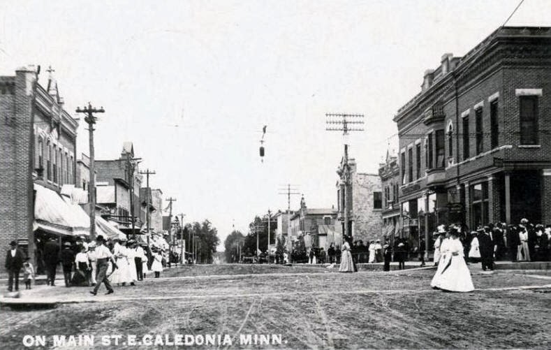
[19] Eitzen was also platted about this same time. Numerous other villages were platted in the county by optimistic entrepreneurs. Some existed on paper only, others had a business or two and a post office for a time, and a few are still in existence today with larger populations than any time in the past. The county seat was the village of Houston for a few years, but the county commissioners moved the official records to Caledonia for safe storage in the cabin of Commissioner Samuel McPhail. The first court hearings were held in that cabin, and a one-story courthouse and jail was built in Caledonia in 1857.

Minnesota Statehood

Figure 21. Map of Houston county, Minnesota, 2001.
Minnesota was admitted as the 32nd state on 11 May 1858. A month before, in anticipation of statehood, the county commission established 15 townships, and on 13 August 1858 the state legislature confirmed them: Hamilton (later renamed Money Creek) in the northwest corner, Yucatan, and Spring Grove at the west and in Range 7; Houston, Sheldon, Caledonia, and Wilmington in Range 6; Union, Mayville, and Winnebago in Range 5; and La Crescent, Hokah, Brownsville, Crooked Creek, and Jefferson at the east border of the county and generally in Range 4. Mound Prairie and Black Hammer townships were created in 1858 and 1859 (Figure 21) from land once part of surrounding townships.

At first the villages operated as part of the township that surrounded the village. Gradually seven villages each were granted legal status as incorporations separate from the township. Brownsville, Caledonia, Eitzen, Hokah, Houston, La Crescent, and Spring Grove were later upgraded to cities by an act of the legislature. These seven cities and 17 townships form the local level of government in Houston County in existence today.

Turmoil over the county seat continued, a two-story building was built in Caledonia in 1867, and several referenda allowed Caledonia to prevail as the county seat by 1874. From that point on, Caledonia prospered, and Houston slowly diminished. The only other area of prominence was La Crescent, which benefited from its connection to La Crosse, Wisconsin.

Immigration Waves

Soon after the region was open to settlement, agents published stories of the verdant land and new opportunities.[20] “The earliest settlers were largely Irish. Norwegians settled in the western and southwestern parts of the county near Spring Grove. Germans settled near Eitzen and the northern part of the county. Luxemburgers [sic] settled around Caledonia and Freeburg.” Among the settlers from Luxembourg—the Palens from Harlange and Schwindens from Kaundorf[21]—were German families from the Trier area, including the Reinerts from Igel, the Arnoldy families from Kaschenbach, and Konzems from Temmels and Igel (or other towns).

Several immigrant families set up as shop keepers, but the majority became farmers. The University of Minnesota documented how farming developed in the county.
Farming in Houston county has passed through several periods in which different systems of farming were tried and abandoned. During the pioneer period, nearly all products were consumed at home. In the mid 1860s, wheat growing became profitable because of the rapid development of farm machinery and the increased demand for food stimulated by the Civil War.(13) For several years wheat was the only crop grown on some farms. During this time Brownsville was an important shipping center, receiving wheat from as far as 50 miles inland. Wheat growing was nearly discontinued by the end of the 1880s due to crop losses from disease and insect damage.
After the decline of wheat as a main crop, hog raising became the major farming enterprise. Corn grown in large fields was not well suited to the highly erodible sloping soils. Corn growing during this period involved intensive tilling of the soil to prepare a seedbed and many cultivations to control weeds.(10) The resulting loss of organic matter, poor soil tilth, and large fields of exposed soil led to severe gully erosion. Erosion was so severe that some fields were abandoned.
Dairy farming began in the 1890s but did not become important until about 1910. Dairying and beef production are well suited to the sloping to very steep topography. Dairying largely utilizes the more productive soils on the summits and upper side slopes of the ridge tops. Forage crops are fed in large amount to dairy cattle. These crops are very productive on the silty soils; at the same time forage crops provide a cover of sod that protects the soil from erosion. Relatively large areas are too steep for cropland but are suitable for pasture that supports beef cattle enterprises.
Today’s system of livestock farming is basically in harmony with the climatic and soil conditions in the county. Since 1935, conservation practices have been applied to most farms. Most ridge top farms have contour strips. Gullies have been filled, shaped, and seeded to grassed waterway. Terraces are also used on some farms. These practices, along with diversions and dams that have been built, help reduce flooding in the valleys.
Corn and hay are presently the most important crops grown in Houston county. In 1977, 66,000 acres of corn was planted to grain or silage, 57,300 to hay, 16,400 acres to small grain, and 2,800 acres to soybeans.
Livestock numbers have been increasing steadily in Houston county. In 1977, 91,600 head of cattle and calves were in the county, of which 17,600 were dairy cows. Additionally, there were 140,000 hogs, 55,000 chickens, and 500 sheep.
In 1977, there were 1,395 farms in the county. The average farm was 237 acres. Approximately 165,000 acres were used as crop land.(17)[22]
Neill provided notes on the development of religious congregations from about 1840 to 1880. He documented these communities of religions in the county.[23]
  • Catholic in Brownsville, Caledonia, Crooked Creek, Hokah, Houston, Jefferson, La Crescent, and Wilmington
  • Evangelical Lutheran in Brownsville, Crooked Creek, Hokah, Houston, Mound Prairie, Sheldon, Spring Grove, Union, Wilmington, and Winnebago
  • Episcopal in Caledonia and Houston
  • Presbyterian and Congregational in Brownsville, Caledonia, Hokah, Houston, La Crescent, Sheldon, and Yucatan
  • Methodist in Brownsville, Caledonia, Crooked Creek, Hokah, Houston, La Crescent, Money Creek, Sheldon, Union, Wilmington, and Winnebago
  • Baptist in Houston, Money Creek, and Winnebago
  • German Reformed in Mound Prairie, Union, and Winnebago
  • United Brethren in Christ in Houston
  • Disciples in Union
  • Christian in Brownsville
  • Non-denominational in Black Hammer
Catholic churches remain today in La Crescent, Hokah, and Brownsville. However, only two rectories are occupied by resident priests.

Previous sections: Background for family historyParish, Local Development
Next sections: Reinert History in the Area, Travel to Kansas in 1872, Tipton KS, Seguin KS, La Crosse WI

Notes

18

The historical notes in this section are derived from an essay by the Houston County Historical Society, accessed 2013.10.19. Some corrections were made based on information in Neill.

19

Neill, p. 274.

20

How did agents receive information about the county? Do advertisement schemes exist that document the agents’ work? These simple questions might require a great deal of research.

21

The source of these two assertions is not clear. Perhaps from a Reinart researcher, .

22

Soil survey of Houston County, Minnesota, Robert A. Lueth, United States. Soil Conservation Service, University of Minnesota. Agricultural Experiment Station. Pages 2-3. Accessed 2013.10.19. Internal citations to 10: Marvin Simon, 1965 Pioneers forever, Whiting Press, pp 101 and 102; 13: Soil Survey USDA 1929, p 36; and 17: USDA MN Crop and livestock reporting.

23

Neill, pp. 327 (Black Hammer), 340 (Brownsville), 359-361 (Caledonia), 382 (Crooked Creek), 393-394 (Hokah), 408-410 (Houston), 420 (Jefferson), 429-430 (La Crescent), 439 (Money Creek), 450 (Mound Prairie), 455-456 (Sheldon), 467-469 (Spring Grove), 485-486 (Union), 491-492 (Wilmington), 501-503 (Winnebago), and 510 (Yucatan).

Houston County, Minnesota—Reinert history in the area

This post is a stub, subject to frequent updates. First publication [not published]. © Thomas G. Kohn, 2013.

Although the Reinert family lived in Houston county only five years, their life should have left these records, which require further research.
  • School attendance for Nicholas (age 16 through perhaps 18), Peter (ages 14 through perhaps 18), Mary (ages 7 to 12), and Gertrude (ages 6 to 8)
  • Burial of John Reinert
  • Confirmations of Nicholas and Peter, possibly Mary and Gertrude
  • Lease agreements for the farm property
  • Tax forms for 1868 through 1872
  • Auction notices and receipts for the small property that could not fit in a wagon
A news item and advertisement in the Houston County Journal of 25 June 1872[24] received some attention.
Buffalo Land.

We are in receipt of this new and most agreeable volume of over 500 pages from the press of E. Hannaford & Co., (Publishers of First Class Subscription Books, Cincinnati and Chicago) The author is Hon. W. E. Webb, of Topeka, Kansas, long and widely known from his connection with the interests of emigration, and a strikingly original and jocular humorist.

He describes the wealth and wonders, the mysteries and marvels of the boundless West—that wild region so much talked about, yet as little understood, whose growth and development seem like a tale of Eastern magic. It is superbly illustrated, containing no less than fifty-three original and striking engravings, from actual photographs and designs by Prof. Henry Worrall, and executed (the enterprising publishers assure us) at a total cost of over $2,800.

In a short review like this, it is, of course, impossible to convey a perfect idea of this admirable work. To any one who has the least touch of “the Western fever,” it must prove really invaluable; and for all classes of readers, without execution, it is the liveliest and most laugh-provoking book we have seen for many a day. It abounds with valuable information, the reliability of which is vouched for by Governor Harvey, of Kansas, and others. It fairly brims over with wit and humor, and many of its chapters rival Mark Twain’s happiest style.

“Buffalo Land” embraces a wide and varied range of topics, among them the following:

Details of great interest and importance concerning the natural features, vast resources, rapid development, and almost incredible progress of the far Western States and Territories, with glimpses of their mighty future;

Curious and interesting facts connected with the climatic and other changes consequent upon the settlement and denser population of the newly-reclaimed Western lands;

Fresh and authentic information, from official sources, respecting the supply of fuel and lumber available for use on the Great Plains: the cost of a farm, what the emigrant should bring with him, stock-raising at the West, &c.

A full summary of the Homestead and Preemption laws and regulations, prepared by a former Register of the U.S. Land Office.

Full and accurate descriptions of the habits, characteristics, etc., of the savage red man, buffalo, elk, antelope, etc., as found in their native wilds and on the out-skirts of civilization;

Graphic and thrilling narratives of hunting adventures, stalking the bison, encounters with Indians, etc.;

Vivid pictures of life on the frontiers; the past and present of the Great Plains; the vast inland sea, and the marvelous animal life with which it once teemed;

Highly interesting accounts of the geological wonders of the West, antiquarian and scientific researches, etc.

The publishers desire agents for t everywhere, allowing exclusive territory and the most liberal commissions. The firm is a prompt and reliable one. We give their address in full: E. Hannaford & Co., 192 West Madison Street, Chicago, Ills. Many of our readers will want this book, and agents will make money rapidly in its sale.
The book created excitement among residents of the county. A couple residents travelled to Kansas and returned to verify many of the claims made in Buffalo Land. In September 1872, Nicholas Arnoldy liquidated his business, and with his brothers Michael, Peter, and Chris formed a wagon train, and Katherine decided to join Peter Jacobs, Franz Mergen, Matt Ellenz, William Schwinden, Nick Gasper, Philip Schroeder, John Beck, John Elser, Mike Cordel, and John Cordel—about a dozen families who left for Tipton, Kansas.[25]

Previous sections: Background for family historyParish, Local Development, History
Next sections: Travel to Kansas in 1872, Tipton KS, Seguin KS, LaCrosse WI

Notes

24

Volume VII, number 32, page 2. The book Buffalo Land is available in a Kindle edition.

25

 Dreiling, Michael P., A Brief History of the Saint Boniface Parish, (Saint Boniface Church, Tipton; 1937). Section XI: The Parishioners.

26


27


28


29


30


Houston County, Minnesota—background for family history

First publication 2013.11.13. © Thomas G. Kohn, 2013.

John Reinert and his wife Katherine Blasius-Reinert arrived in the U.S. around March of 1867. To date, no ship’s passenger list has been found to document their exact arrival.[1] The Prussian commander of the militia signed a permit for emigration on 9 February 1867. If the family left Germany soon afterward, travel to Le Havre, France might require a week, and ship passage about three weeks. Thus, it is likely they arrived in March.

The family traveled with five children aged 19 (Susanna), 16 (Nicholas), 14 (Peter), 7 (Maria), and 3 (Gertrude). Their most likely port of arrival was New York City, and they may have been processed through Castle Clinton (also called Castle Garden).[2] However, it is possible their ship landed in Hoboken NJ. The family stayed some time with one or more of Katherine’s siblings. Her brother Nicholas Blasius lived in New Trier township, Cook county, Illinois; her sister Anna Catharina Blasius-Schmitz-Simon also in New Trier township or the nearby town of Wilmette; and her brother Johann Blasius lived in Chicago.

Figure 1. Caledonia township, Houston county MN, 1871
An informal family history holds that they had settled near Caldedonia in or after 1867. By the Ninth U.S. Federal Census of 1 June 1870, John Reinert and his family lived in Houston county, Minnesota. Their home in Minnesota was a farm about one and one-half miles north and three to four miles west (red square in Figure 1) of the village of Caledonia (red polygon). The farm might have included crops like flax, which the father John Reinert had experience with in Germany. No deed exists to show ownership, so it is likely they leased the farm.

Figure 2. John Reinert Household entry, U.S. Federal Census 1870
The enumeration of household 127 in the 1870 census (Figure 2)[3] identifies John Reinert as “John Rinerd” (age 50, farmer with real estate valued at $1700 and personal estate valued at $400) and his family as Catherine (46, keeping house), Susanna (22), Nicholas (19), Peter (17), Mary (10), and Gertrude (5).

Other families enumerated before and after the Reinerts include these households.
  • William Paddock (dwelling 118, household 112, in section 10)
  • James Mulligan (dwelling 119, household 113, in section 10)
  • Delmer Irvin (dwelling 120, household 114, section 10)
  • Michael Lorig (dwelling 121, household 115, not found as an identified land owner)
  • James Lochead (dwelling 122, household 116, “Lockard” in section 3)
  • John Schmitt (dwelling 123, household 117, in section 3)
  • Gunder Knudson (dwelling 124, household 118, in section 3)
  • Edmund Powell (dwelling 125, household 119, in section 3)
  • Jacob P. Bakin (dwelling 126, household 120, “Becker” in section 3)
  • Dwelling 127, household 121 is the John Reinert family
  • Daniel McCarty (dwelling 128, household 122, in section 3)
  • Michael Allen (dwelling 129, household 123, “M. Ellings” in section 9)
  • Patrick Jennings (dwelling 130, household 124, in section 9)
  • Catherine McGloughlin (dwelling 131, household 125, “Laughlin” in section 9)
  • Michael Jennings (dwelling 132, household 126, perhaps occupant of “P.Jennings” in section 4)
  • John Hashite (dwelling 134, household 128, “M.Hastings” in section 4?)
  • Nicholas Pirrotte (dwelling 135, household 129, in sections 9 and 10)
  • Frank Wis (dwelling 136, household 130, not found as an identified land owner)
  • Anna Shields (dwelling 137, household 131, not found as an identified land owner)
Figure 3. Neighboring households to John Reinert, Caledonia twp
The household locations are shown as numbers in Figure 3. Two small squares indicate dwellings that are not enumerated with a family. They are possible locations for the John Reinert family.

It is likely that John swore his intention to become a citizen at the District Court of Minnesota in Caledonia on 23 October 1867. However, the signature could be read as “John Reinart,” who was a different immigrant who lived in Houston county at the same time.

John Reinert died from throat or neck cancer in March of 1871. The parish registers do not include burials of 1871,[4] and his grave is not recorded in the Caledonia parish cemetery. Katherine and the children kept the farm running for about a year.

Geography

The land features of Houston county, and for that matter, much of Minnesota and Wisconsin along the upper Mississippi River, resemble those of the middle Mosel River. Meandering tributaries feed the broadly flowing Mississippi, which is bounded by the bluffs that rise above the river.

Figure 4. Map of Houston county, Minnesota, 2003
The Root River flows east through the north third of Houston county and beside the towns of Houston and Hokah. Tributaries of the Root River from the north are Storer, Silver, and Money Creeks. North of Houston on Money Creek, a tributary of the Root River, is the unincorporated village of Money Creek. Also north of the Root River are Pine Creek (unincorporated) and the largest town of the county, La Crescent, which overlooks the Mississippi floodplain across from La Crosse, Wisconsin. South along the Mississippi are the towns of Brownsville and Reno (unincorporated).

The southern three-fourths of the county rise as much as 500 feet above the Mississippi, and most of the climb occurs in the bluffs above the western bank of the river. Tributaries of the Root River from the south are, in westward order, Thompson Creek (formerly also known as Indian Spring Creek), Crystal Creek, and Badger, Beaver, and Riceford Creeks. Thompson Creek was named in honor of Edward Thompson and his brother, Clark W. Thompson, the principal founders of Hokah. Caledonia sits in the center of the broad plateau above the rivers, among gently rolling hills that might have reminded John Reinert and his family of the plateaus above Wasserbillig and Igel. The land is fertile but often steeply sloped. The farming typical to the area includes raising soy beans, corn, and livestock feed crops. The area is not populated very heavily today, with the average town size of about 700 residents. The other towns on the plateau are a combination of unincorporated areas (Yucatan, Sheldon, Black Hammer, Riceford, Newhouse, Wilmington, and Freeburg) and incorporated villages (Spring Grove and Eitzen).

Next sections: Parish, Local Development, History, Reinert History in the Area, Travel in 1872, Tipton KS, Seguin KS, La Crosse WI

Notes

1

Several online sources provide transcripts of ship manifests, including an index of arrivals by year,  (an index of departures by port, including Le Havre, a searchable database of NARA records, and the Dayton and Montgomery County Library has most volumes from Germans to America: Lists of Passengers Arriving at US Ports 1850-1897 (Ira A. Glazier and P. William Filby (the correct volume to search is Vol. 19).

2

On August 3, 1855, Castle Garden opened as an immigrant landing depot. The creation of Castle Garden represented a country at a crossroads, signaling a change in American immigration policy, and in the ways through which immigrants became Americans. Two out of every three immigrants to the United States in this period passed through the Castle Garden. It was closed on April 18, 1890 and immigrant processing was moved to Ellis Island.

3

Ninth U.S. Federal Census of Houston county, Minnesota; page 18, dwelling 127, household 121, lines 10 through 16.

4

Email of Oct 17, 2013 “Re: Parish records from 1871” from Maria Keefe (stmaryschurch@acegroup.cc) “Unfortunately, we have very few records dating as far back as 1871. Of the few we have, I was not able to locate any burial records for John Reinert.”

2013-11-03

Who's missing in my background data?

Note: This post is an excerpt from ongoing research that I've made available at scribd.com. Updated on 2013.11.08 to include research on the Kansas state census of 1895. © Thomas G. Kohn, 2013.

The Reinert family had a drive to succeed in a country that was composed of other immigrants. John and his children adapted their farming to a landscape that challenged them to tend larger fields and grapple with varied arability.

Our family arrived as immigrants at the ports in New York City, New York and Hoboken, New Jersey. The Blasius branch of the family spent significant time in Chicago, Illinois and nearby New Trier township. The Reinert branch spent significant time in these locations.
  • Houston county and Caledonia, Minnesota
  • La Crosse, Wisconsin
  • St. Donatus, Iowa
  • Osborne county and Mitchell county, Kansas, to include the towns of Tipton, Osborne, and Cawker City
  • Sheridan county, Gove county, Logan county, and Thomas county, Kansas, to include the towns of Seguin, Oakley, Grinnell, Grainfield, Park, Quinter, Colby, Hoxie, Selden, and Dresden
Little other than the marriage location is known about the origins of many spouses of the Reinert family members. This lack in historical background is a topic for future research.

Sons- and daughters-in-law to John and Katherine Reinert

  • John M. Kohn (1839-1919, husband of Susanna Reinert) came from Wasserliesch, Germany and settled first in or near La Crosse, Wisconsin.
  • Maria Simeon (1861-1960, wife of Nicholas Reinert) came from St. Donatus, Iowa, her birthplace in 1861. The family’s European origin is documented by other researchers as Mettendorf, Germay, which is 42 km (about 30 mi) northwest of Trier, Germany. The family is not mentioned in Early Day Couples of Tipton, Kansas (EDC). [Richardson, Joyce et al, The People Came: In their prairie schooners, through the waves of the seas of grass, and stayed (TPC). Osborne County Genealogical and Historical Society, 1977; p. 53] In the 1895 census, her age, birthplace, and previous residence are given as “34” (thus 1864), “Germany,” and “Iowa.”
  • Catherine Schwinden (1860-1940, wife of Peter Reinert) came from Houston county, Minnesota. Other researchers give her family’s European origin as Mettendorf, Rheinland-Pfalz. The family is not mentioned in EDC or TPC. [Refer to http://www.oocities.org/heartland/bluffs/8479/reinart.html (Gehling family), http://pages.suddenlink.net/mack/histories/MathiasReinart.htm (Carroll Biographies), http://pages.suddenlink.net/mack/familytrees/database/b127.htm (Paul Mack), http://reinart.ancestry.angelfire.com/family-trees.html (Reinart Family Ancestry) for parallel research. In the 1895 census, her age and birthplace are given as “34” (thus 1861) and “Minnesota.”]
  • Michael Gillen (1854-1913, husband of Maria Reinert) was born in “Cruchten, Rhine Province, Germany” in 1854. [EDC, p. 49 mentions no other residences in America, but the biographical sketch for Michael’s cousin, Nicholas Carl on p.42, might indicate a short residence in Houston county, Minnesota. The cited “Cruchten” might be modern-day Kruchten, Rheinland-Pfalz, which is 24 mi (39 km) northwest of Trier or perhaps Cruchten, Nommern, Luxembourg, which is 57 km west from Trier and 16 mi (26 km) north of the city of Luxembourg.]
  • Stephen Schandler (1861?-1938, husband of Gertrude Reinert) was likely born in Pratz, Luxembourg and likely resided in Dubuque, Iowa or Useldinger (perhaps Luxembourg) before settling in the Tipton area. [EDC, p. 55 cites Pratz in a biographical sketch for Stephen’s brother, Peter Schandler. TPC p. 54 states the Schandler “family had first moved to Useldinger where they operated a grocery store before coming to America. He ran the Tipton Telephone Exchange with Gertrude. After Gertrude died, he married a Konzem and sometime later moved to Lincoln, and then moved again to Wichita,.” In the 1895 census, his age and birthplace are given as “33” (thus 1862) and “Germany.”]

Sons- and daughters-in-law to John M. and Susanna Kohn

  • Elizabeth Ottley (1880-1947, wife of Peter Kohn) was born in Osborne county. Her parents were born in Luxembourg, Martin Ottley in 1842 and Mary Huberty in 1855. The exact locations are unknown. [EDC, p. 37. In the 1895 census, their birthplaces are given as “Germany.” Her age is 15 and birthplace is Kansas.]
  • Louise Ohnsat (1875-1959, wife of Mike Kohn) was born in Pittsburgh, Pennsylvania, and her family settled in Osborne county in 1878. Her father emigrated from Grüben, Ostpreußen (modern-day Grabin, Poland); her mother emigrated from Breisach-am-Rhein, Germany. [EDC, p. 20. The European origins are the result of my own research into this family line.]
  • Phillip Gasper (1877-1964, husband of Katherine Kohn) was born in Osborne county. One of his brothers was born in “Schlertweiler bei Trier Germany” in 1873. [EDC, p. 1. This may refer to modern-day Zemmer-Schleidweiler, Germany (postal code 54313), which is 13 mi (21 km) from the center of Trier. See also TPC, pp. 39-41, which provide more exact locations of their homes in Bloom township.]
  • Frank Streit (1882-1956, husband of Annie Kohn) was born in Osborne county. His brother John came to America as a small child in 1877, and the family came from Trier around 1877. [EDC, p. 7; TPC, p. 58 includes a biographical sketch of Henry Streit, Sr. that cites the birthplaces as Trier, Germany for him and Schleidtweiler, Germany for his wife Anna Maria Schmitt. In the 1895 census, Frank’s age and birthplace are given as “14” (thus 1881) and “Kansas.” His father Henry (age 44) and mother Mary (age 46) were both born in Germany.]
  • Barbara Streit (1887-1974, wife of Ben Kohn) was born in Osborne county. She is a sister to Frank Streit. [EDC, p. 7; TPC, p. 58 includes a biographical sketch of Henry Streit, Sr. that cites the birthplaces as Trier, Germany for him and Schleidtweiler, Germany for his wife Anna Maria Schmitt. In the 1895 census, Barbara’s age and birthplace are given as “7” (thus 1888) and “Kansas.” His father Henry (age 44) and mother Mary (age 46) were both born in Germany.]

Sons- and daughters-in-law to Nicholas and Maria Reinert

  • Barbara Boden (1883-1969, wife of Peter Anton Reinert) was born in Osborne county. The family’s European origin is unknown.[EDC, p. 12. The Boden biographical sketches in TPC (p. 36) do not name a European location, but a passing reference on p. 39 might indicate Franz Boden came from Schleidtweiler, Germany. In the 1895 census, her age and birthplace are given as “12” (thus 1883) and “Kansas.” Her father was 50 from Germany, a woman Mary (age 30 born in Iowas and from Nebraska) was in the household.]
  • Mary Rohlman (1885-1971, wife of John Peter Reinert) likely was born near Willowdale, Kansas. [EDC, p. 58.] The family’s European origin is unknown. The family is not mentioned in EDC or TPC.
  • Annie E. Rohlman (1889-1918, wife of Nicklous B. Reinert) likely was born near Willowdale, Kansas. The family’s European origin is unknown. The family is not mentioned in EDC or TPC.
  • Maggie Bach (1881-1955, wife of Nicklous B. Reinert) was born in Osborne county. Her father was born in “Province, Germany” in 1837 and first settled in Wisconsin; her mother in “Hargartin, Rhine Province, Germany” in 1848. [TPC, p. 35. In the 1895 census, Maggie’s age and birthplace are given as “14” (thus 1881) and “Kansas.” Her father John (age 57) and mother Mary (age 43) were both born in Germany.]
  • Elizabeth A. Boberg (1897-1964, wife of Joseph S.H. Reinert) was born in Wallenhorst, Germany, and her family lived in Delphos, Kansas and Glen Elder, Kansas for short times. [EDC, p. 69. Wallenhorst is in Niedersachsen, Germany.]
  • Emma Reinert (Sr. Borgia), Bertha Reinert (Sr. Lambertine), Anton A. Reinert, and Mary Reinert did not marry.

Sons- and daughters-in-law to Peter and Catherine Reinert

I assume that most of the spouses lived in the area of Seguin, Kansas, and that—with the exception of Thomas Thummel—they had no connection to the Tipton, Kansas area.
  • Barbara Deges (1888-1966, wife of William Joseph Reinert) has no information on birthplace or family origins.
  • Thomas Thummel (1877-1942, husband of Mary Catherine Reinert) was born in Ishpeming, Michigan. [EDC, p. 19. In the 1895 census, his age and birthplace are given as “17” (thus 1876) and “Mishgan.” His father B. (age 53) and mother Fannie (age 43) were born in Germany and Wisconsin, respectively.] No specific information on his European origin is available.
  • Mathias Schuetz (1883-1968, husband to Elizabeth Susanna Reinert) has no information on birthplace or family origins.
  • Bertha Holdforth (1890-1968, wife of Carl Mathias Reinert) has no information on birthplace or family origins.
  • Anna Catherine Arendt (1896-1946, wife of Henry Nicholas Reinert) has no information on birthplace or family origins.
  • Anton George Feldt (1890-1973, husband of Anna Catherine Reinert) has no information on birthplace or family origins.
  • William Schwinden (1890?-1945?, husband of Anna Catherine Reinert) has no information on birthplace or family origins.
  • Florentz Henry Neff (1899-1981, husband of Margaret Cleophas Reinert) has no information on birthplace or family origins.
  • Anna Geerdes (1904-2007, wife of Theodore Mathias Reinert) was born in Leoti, Kansas but has no information on family origins.
  • Ruth Adeline Smith (1912-1995?, wife of Gervase Thomas Reinert) has no information on birthplace or family origins.
  • Gertrude Hubertine Reinert and Alex Gregory Reinert did not marry.

Sons- and daughters-in-law to Michael and Maria Gillen

  • John Tucker (1900?-1965?, husband of Catherine Gillen) has no information on birthplace or family origins.
  • Gertrude L. Gillen, John Gillen, and Margaret E. Gillen did not marry.

Sons- and daughters-in-law to Stephen and Gertrude Schandler

  • Henry Mindrup (no dates, husband of Mary Schandler) has no information on birthplace or family origins. [See EDC, p. 55 for a biographical sketch of Catherine Mindrup and her husband Peter Schandler. Perhaps the Mindrup family is the same. Catherine’s home is given as New Almelo, Norton county, Kansas. Catherine’s son, Joseph Schandler is documented in the same sketch as the husband of Delorose Steichen and a farmer east of New Almelo.]
  • Bernice Shore (no dates, wife of Arthur Schandler) has no information on birthplace or family origins.
  • Gertrude Govreau (no dates, wife of Edward Schandler) has no information on birthplace or family origins.
  • Arthur Steinke (no dates, husband of Loretta Schandler) has no information on birthplace or family origins.
  • Delorosa Schandler and Grace Schandler did not marry.